
TOPICS
History & Geo
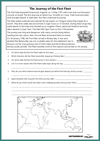
Mapping the Voyage: Draw
EASYTEACHING.NET
Overview:
This drawing activity allows students to map the route of the First Fleet and label key stops along the journey. Designed for middle and upper years students.
Learning Objectives:
- Understand the route taken by the First Fleet and its significant stops.
- Develop map-drawing and geographical skills.
- Reinforce knowledge of historical events related to the First Fleet.
How the Activity Works:
Students are provided with a blank map or an outline of the route the First Fleet took. They will draw the route from England to Australia, marking the key stops along the way, such as Portsmouth, Tenerife, Rio de Janeiro, and Botany Bay. Students should label each stop clearly and may add any relevant details, such as the duration of each stop or important events that occurred during the journey. This activity helps students visualise the historic voyage and strengthens both geographical and historical understanding.
Related resources


EASYTEACHING.NET


