
TOPICS
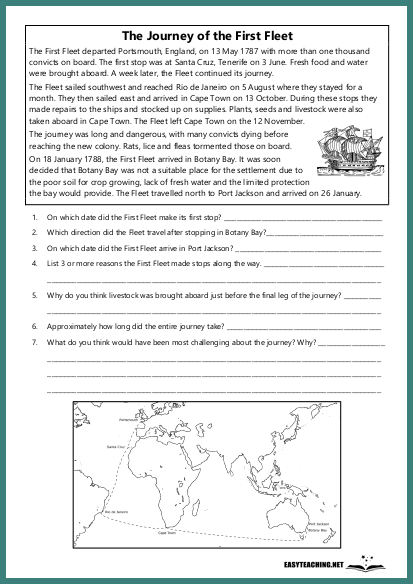
History & Geo
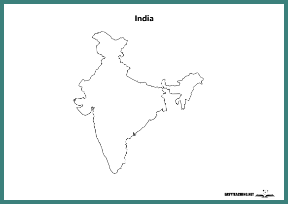
United States (with States)
EASYTEACHING.NET
Overview:
This activity provides a blank map of the United States with state borders but no labels. It is designed to help students identify and label the 50 states of the USA.
Learning Objectives:
- Identify and label the 50 states of the United States.
- Develop map-reading and geographical skills.
- Enhance knowledge of the states' locations and their regional relationships.
How the Activity Works:
Students are provided with a blank map of the United States, showing only the borders of the states. Their task is to label each state correctly. Additional activities could include:
- Researching and adding key facts about each state (e.g., capital cities, population, famous landmarks).
- Colouring each state in a different shade to visually distinguish them.
- Learning about the geographical features of the USA, such as the Rocky Mountains, the Mississippi River, or the Great Lakes.
This activity helps students practise map-reading skills while building a deeper understanding of the states and geography of the United States.
Related resources


EASYTEACHING.NET


