
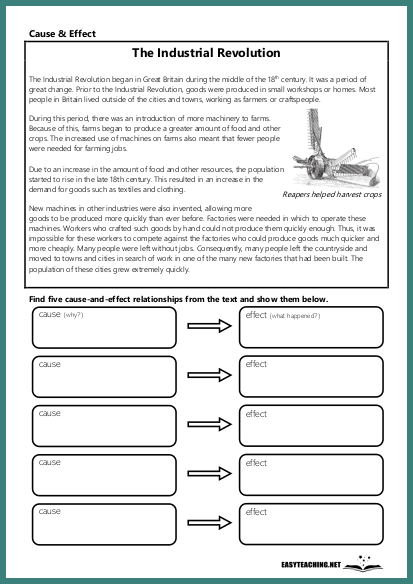
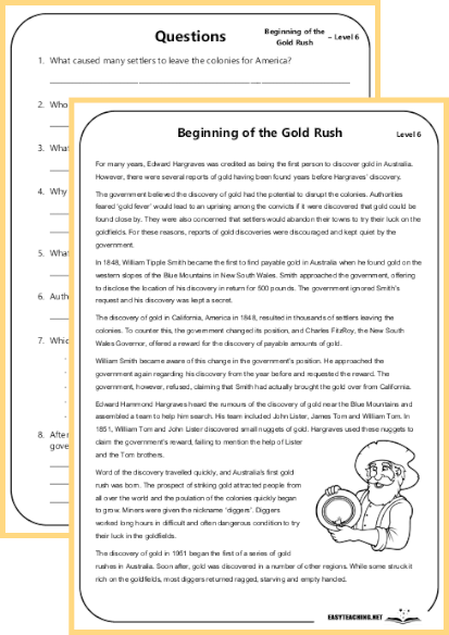
TOPICS
History & Geo
Label & Colour a World Map (2)
 Available only to premium members
Overview:
This activity involves labelling the continents on a world map and colouring each continent according to specific instructions. Students will also label the oceans and list two countries from each continent. It is designed to reinforce geographical knowledge and map-reading skills. Suitable for middle and upper years students.
Learning Objectives:
- Label the continents and oceans correctly.
- Colour each continent according to instructions.
- Identify and list two countries from each continent.
- Develop map-reading and geographical skills.
How the Activity Works:
Students are provided with a blank world map where they need to label the continents and oceans. They follow instructions to colour each continent with a different colour and then list two countries from each continent. This activity allows students to engage with the geographical layout of the world while also enhancing their understanding of continents and countries.
 Become a member
Related resources


EASYTEACHING.NET


