
TOPICS
History & Geo
Label the Continents Word Map (B&W)
Overview:
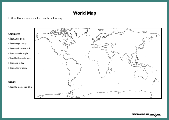
A black and white world map for students to fill in the names of the continents. Designed for middle and upper years students.
Learning Objectives:
- Identify and label the continents on a world map.
- Develop geographical skills and improve map literacy.
- Strengthen knowledge of global geography.
How the Activity Works:
Students are given a black and white world map with the continents outlined but not labelled. Their task is to fill in the names of the continents (Africa, Antarctica, Asia, Europe, North America, Oceania, and South America) in the appropriate locations on the map. This activity can be enhanced by asking students to identify and label major countries or landmarks within each continent. After completing the map, students can colour it in to help visually distinguish each continent. This exercise helps students learn the geographical locations of the continents while also practising map-reading skills.
You might like: World Map Activity Sheet
Related resources


EASYTEACHING.NET


